Plaine des Cafres
Plaine des Cafres
A vast agricultural plateau at 1,500 m altitude in Tampon Highlands, Plaine des Cafres blends pastoral landscapes, colourful Creole houses, and privileged access to Piton de la Fournaise.
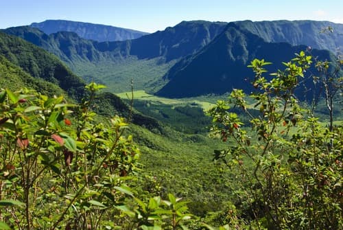
Plaine des Cafres is a vast volcanic plateau located in the Highlands of Réunion, in the commune of Tampon, at approximately 1,500 metres altitude. Crossed by National Route 3, this agricultural and pastoral plain offers an open, misty landscape rare on the island. It also serves as the main gateway to Piton de la Fournaise, one of the world's most active volcanoes.
Practical information at a glance
- Access: National Route 3 from Saint-Pierre or Saint-Benoît; accessible by car or yellow bus (Kar'Ouest / Car Jaune network).
- Altitude: Approximately 1,500 m — bring warm clothing, even during the austral summer.
- Recommended duration: Half a day for the plain alone; full day combining with the volcano.
- Weather: Frequent mist in the afternoon; mornings often clearer.
What to see
The plateau stretches across several kilometres of meadows, rosat geranium fields, and cattle farms. Wooden Creole houses painted in bright colours dot the landscape. Cité du Volcan, a museum dedicated to volcanic activity in Réunion, is located in Bourg-Murat, the plain's main village. On clear days, Piton de la Fournaise appears on the horizon.
History and context
The name "Cafres" refers, in Réunion's history, to enslaved people of African origin who populated these high plateaus after their emancipation. The plain was gradually cleared during the 18th and 19th centuries. Dairy farming and geranium cultivation shaped a distinct agricultural identity separate from the sugar-growing coast.
Highlights of your visit
Cité du Volcan
This scientific museum in Bourg-Murat traces the volcanic history of Réunion and Piton de la Fournaise. Scale models, rock collections, films, and interactive exhibitions help you understand the island's geology before heading up to the crater.
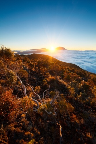
Panoramic view of Piton de la Fournaise
From the volcano road (extended RN3), the landscape gradually transitions from green pasture to black lava flows. Pas de Bellecombe-Jacob, the starting point for hikes to the crater, lies beyond the plain.
Creole architecture of the Highlands
Bourg-Murat and surrounding hamlets preserve wooden Creole houses with verandas and coloured shutters, testimony to mountain dwellings characteristic of Réunion's Highlands.
Local markets and produce
The plain produces milk, artisanal cheeses, honey, and geranium essential oils. Several farms sell directly; ask local residents for recommendations.
Photography tips
Morning light, before mist arrives, is ideal for photographing meadows with the volcano in the background. Colourful Creole houses respond beautifully to soft morning light. In misty conditions, the hazy atmosphere over pastures creates distinctly atmospheric images.
Location and access
Plaine des Cafres is located in Tampon Highlands, accessible via RN3 from Saint-Pierre (south coast) or Saint-Benoît (east coast). The Car Jaune network serves Bourg-Murat. The plain is the logical starting point for reaching Piton de la Fournaise and Pas de Bellecombe-Jacob.
Nearby attractions
- Piton de la Fournaise — Réunion's active volcano, accessible by hiking from Pas de Bellecombe-Jacob.
- Cité du Volcan — Scientific museum in Bourg-Murat, essential before or after climbing to the crater.
- Plaine des Palmistes — Neighbouring, more forested plateau, known for its palmistes and forest atmosphere.
- Bélouve-Bébour Forest — High-altitude tropical forest accessible from Plaine des Palmistes, rich in tree ferns.
Frequently asked questions
The austral dry season (May to November) offers the clearest days. During austral summer (December to April), mist and rain are more frequent, especially in the afternoon.
A car is strongly recommended to explore the plain and continue to the volcano. The Car Jaune serves Bourg-Murat, but schedules are limited and don't reach Pas de Bellecombe-Jacob.
At 1,500 m altitude, temperatures are cool even during summer. Bring a jacket, light waterproof, and closed shoes, especially if you're heading up to the volcano.
Yes, this is the classic route. Start early from the plain, head to Pas de Bellecombe-Jacob for the hike to the crater, and return by late afternoon. Plan for a full day.
Cité du Volcan is a paid museum. Please check directly with the museum for exact admission fees and opening hours, as these may change.
Photos
Want to discover this destination?
Our local advisors design your tailor-made trip.