Grand Étang de Saint-Benoît
Grand Étang de Saint-Benoît
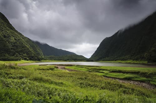
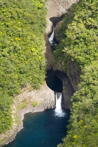
Grand Étang is a crater lake nestled in the humid tropical forest of Saint-Benoît. A marked trail of 2 h 30 to 3 h crosses tree ferns and dense understory to reach this still body of water, encircled by vegetated cliffs.
Grand Étang is a crater lake set deep within the tropical forest of Saint-Benoît, on the windward side of Réunion. Fed by the abundant rainfall of the eastern coast, it stretches across a densely vegetated cirque, accessible via a well-marked forest trail. It is one of the rare hikes on the island that leads to a natural body of water, within the atmosphere of humid primary forest.
Practical info at a glance
- Access: departure from the Grand Étang parking area, reachable via forest road from Saint-Benoît (RN2 then secondary road toward Bras-Canot).
- Suggested duration: allow 2 h 30 to 3 h round trip for the main trail to the lake.
- Difficulty: moderate — muddy trail in rainy weather, minimal elevation gain.
- Gear: waterproof hiking boots strongly recommended; the track is often waterlogged.
- Entry: free.
- Accessibility for people with reduced mobility: not accessible — dirt trail, slippery passages.
What you'll see
The trail crosses dense hygrophilous forest: tree ferns, colorwood trees, pandanus and wild orchids line the path. Upon arrival, the lake appears nestled in vegetation, its dark waters reflecting the canopy. Ducks and endemic birds frequent the shores. On clear days, the wooded cliffs encircling the lake create a closed panorama, almost mineral in quality.
History and context
Grand Étang occupies an ancient volcanic crater filled in by sediment and water flow over time. It is part of the trail network managed by the National Forest Office (ONF) of Réunion. The surrounding forest is classified as a strong protection zone within Réunion's National Park, which prohibits any picking and wild camping.
Highlights of the visit
The hygrophilous forest
From the first metres, the vegetation changes radically. Tree ferns reach several metres in height. Permanent humidity sustains the atmosphere of dense tropical understory, quite different from the dry landscapes of the western coast.
The lake itself
The body of water is calm, encircled by vegetated cliffs. You can follow part of the shoreline on a secondary trail. The lake's surface reflects the forest on windless days — a rare moment of silence on the island.
Bras-Canot waterfall (variant)
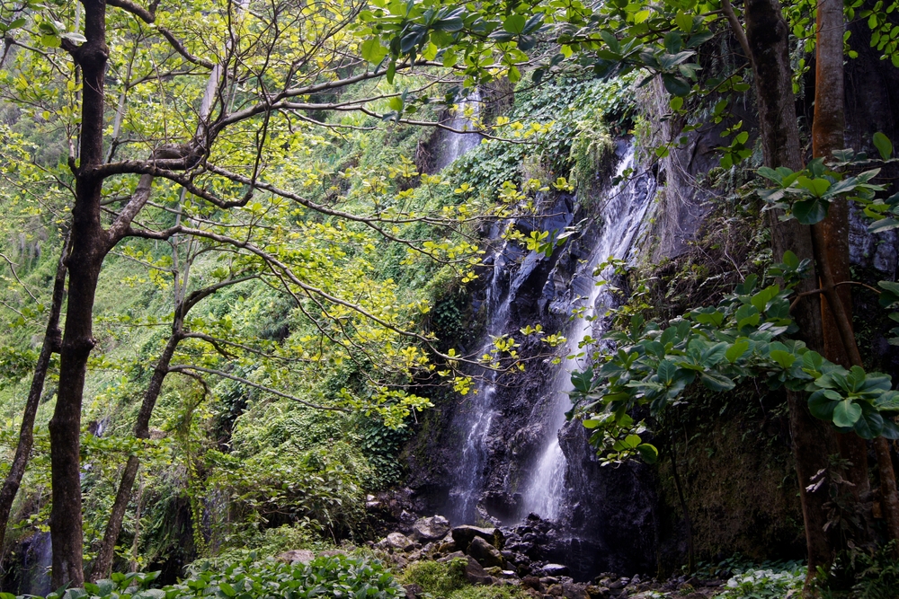
A branch of the trail leads to the Bras-Canot waterfall, accessible by extending the hike. This detour adds around an hour to the route and passes through even wilder areas.
Photography tips
Light filtering through in the morning, before clouds cover the windward side, offers the best conditions. The lake is often in shadow by afternoon. Bring a wide-angle lens to capture the canopy and tree ferns. Protect your equipment: humidity is constant, even in dry weather.
Location and access
The starting point is around ten kilometres from central Saint-Benoît, reachable by car via the RN2 then a forest road. No public transport serves the parking directly. The site is part of the Réunion National Park. Local guides offer group outings or accompaniment for less experienced hikers departing from Saint-Benoît.
Nearby
- Niagara Waterfall (Sainte-Suzanne) — family-friendly waterfall, west of Saint-Benoît.
- Saint-Benoît waterfront — local market and seafront to end the day.
- Bélouve Forest — another forest massif on the windward side, with views over the Salazie cirque.
- Salazie Cirque — accessible from Saint-André, landscapes of waterfalls and Creole villages.
Frequently asked questions
The southern dry season (May to November) offers the best conditions. The windward side receives rain year-round, but cool season mornings are generally clearer.
The trail becomes very slippery after rainfall, which is frequent on this side. Waterproof hiking boots with treaded soles are essential. Avoid the trail during heavy rain or weather alerts.
Swimming is not recommended and may be prohibited under current regulations. The lake sits in a protected zone of the National Park; check with the ONF before your visit.
Allow 2 h 30 to 3 h for the round-trip route to the lake. The variant including Bras-Canot waterfall adds around an extra hour.
The main trail is marked and accessible without a guide for hikers accustomed to wet terrain. For variants or in uncertain weather, a local guide is recommended.
The site is in a protected forest: no food or public toilet facilities are available at the trail start. Bring water and supplies before you leave.
Nearby
Give it a go!
Our local experts arrange this activity for you.